Depending on geography, definitions of water boundary coastal strips are treated differently because of different rules for defining the legal ownership of coastal waters from country to country. Consequently, these areas are presented differently for some countries in the TomTom database.
For example, in Italy and some other European countries, a separate "dummy" Administrative
layer is provided and identified in the shapefile layer with a "$" in the ORDER00 field
name. In Italy, this is $IT (rather than ITA) to distinguish it from other
actual Administrative A8 areas. It displays as the legal coastal water border for the
country.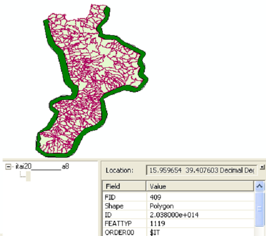
Figure: "Dummy" Administrative Area Highlighted in Italy
In the United States, Canada and in some other countries, a dummy Administrative Area
boundary does not exist. Coastal waters are a part of the Adminstrative Area boundaries of
these countries. See the figure below.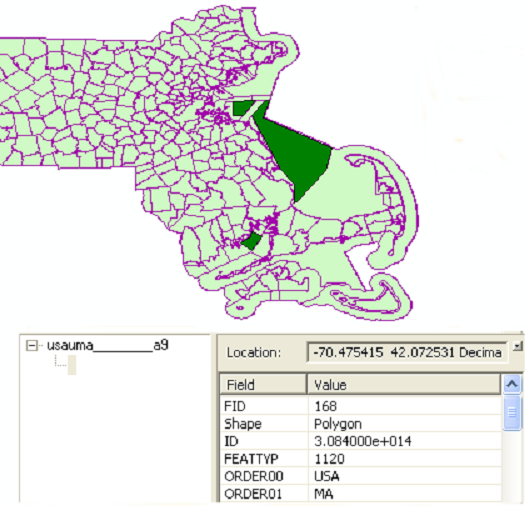
Figure: No Dummy Adminstrative Areas in the United States or Canada (Massachusettes, U.S. Shown)
In order to display or select physical coastal boundaries in countries where a dummy
Administrative Area is not provided, TomTom suggests using the Border Line layer (BL) and
keying on ADMBNDTYP = 10 (Coastal Border).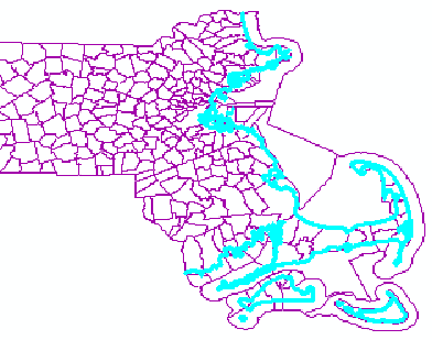
Figure: BL Layer Displayed with ADMBNDTYP = 10 Selected
Note: ADMBNDDC = 1 will also indicate Administrative Area Boundaries that are in
the sea or ocean.