Example of a Level 2 Road
The following drawing shows an example of a Level 2 Road Feature in MultiNet® Shapefile. It shows its comprising elements visually (geometrically) and in a tabular structure.
Figure: Example of a Level 2 Road
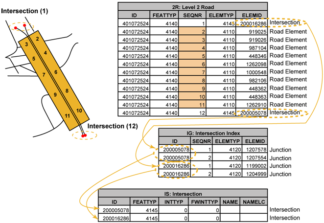
The orange bar indicates all the Road Element parts of a Level 2 Road (five per carriageway). The Level 2 Road shown is a highway segment giving access to a city center and overpassing all crossing Road Elements. Road Elements are split at Level 1 from Administrative boundary crossings, Built-up Area boundaries and other features.
The first Junction of the first Road Element has Junction Type "Bifurcation," which is
visible and circled on the map. Linking the Element ID to the Level 2 Road ID, the complete
Level 2 Road structure is retrieved, with the Intersections at the outer ends of the Level 2
Road.
- More information about the other Elements that are part of these Intersections are found in the ig table.
- The Type and Name of the Intersection is found in the is table.