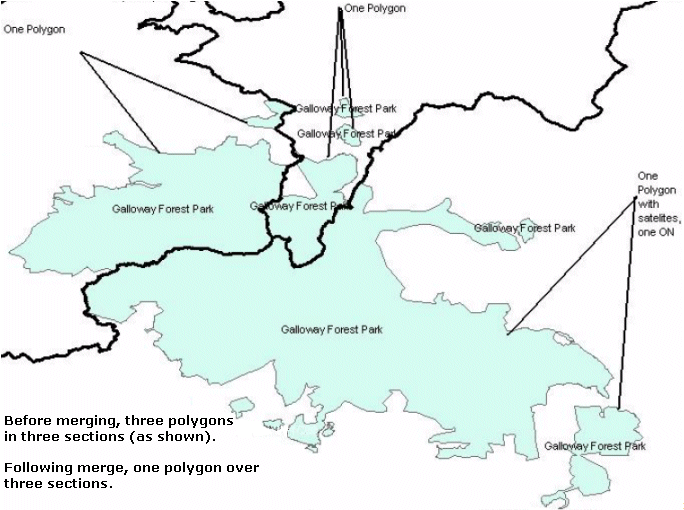
How to Use MultiNet Shapefile and OSL |
Often times, Land Use (lu) and Land Cover (lc) Area features are represented by multiple polygons. This can result in lu and lc official names being displayed multiple times in an application. Merging and Joining of these polygons resolves this problem. The following rules are followed in order to merge or join lu and lc areas correctly.
Display Features that are face based and adjacent have to be merged within the Order 8 Area. The adjacent faces are merged to one object for one feature type, even if they have no Official Name. Non-adjacent faces result in separate polygons.
Figure: Merging and Joining of LU and LC Areas