Water Lines
wl
Water Lines represent only linear water bodies (rivers, canals). A Water Center Line
represents the main river arm. Minor river arms are not taken into account. When it is not
clear which arm is the main river arm, the Water Center Line is then captured for both arms.
A waterway's width, or the shipping lane and other factors will determine which is the main
arm. Within river deltas or river mouths, the main arm generally corresponds with the
shipping lane.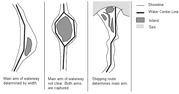 See also Water
Display Class in this user guide for a description of water display classes.
See also Water
Display Class in this user guide for a description of water display classes.
Figure: Water Center Lines